Team: 4 people
Duration: 1 month
Category: Data & Visualization
Created:
Links
Tech Stack
R Shiny Plotly Leaflet
Tags
R Shiny Data Visualization Collaboration
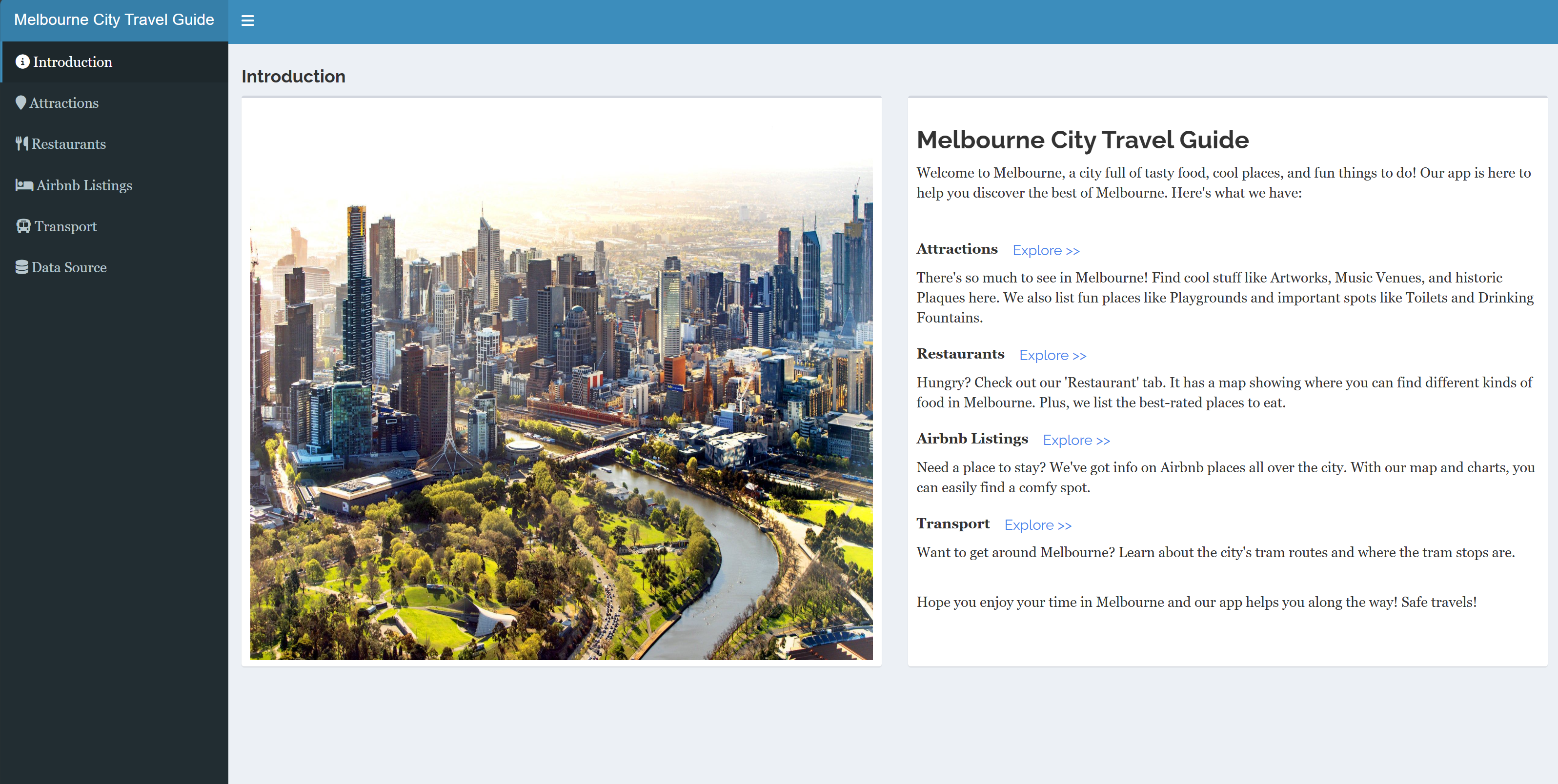
Melbourne City Travel Guide — Interactive City Explorer
An interactive web app that helps visitors (and locals) plan time in Melbourne across food, stays, sights, and transport. It combines open data with an intuitive UI: browse restaurants, Airbnb listings, city attractions, and tram options, then refine with rich filters to build a day-by-day plan. Live on ShinyApps.
Project Gallery
+6
View all
Why it Matters#
City information is scattered across many sources. Tourists need a single map-first view that answers: Where should I eat? What’s nearby? How do I get there—and when is it busy? This guide unifies restaurant details (Places API), short-stay listings (InsideAirbnb), attractions and amenities (City of Melbourne open data), and pedestrian activity so choices are fast, informed, and local-aware.
Key Highlights#
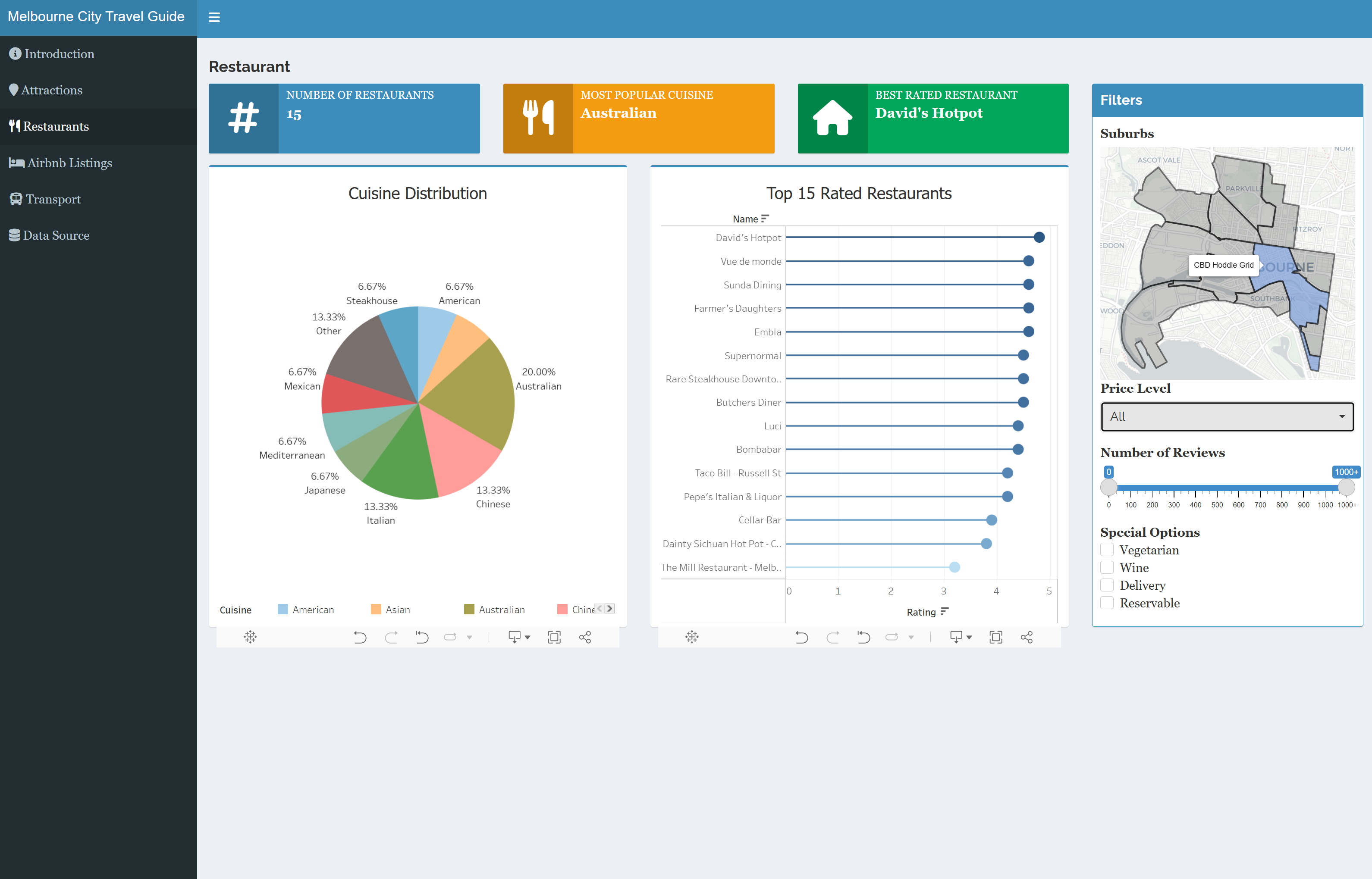
Restaurants#
- Browse top spots with details from Google Places (name, rating, photos) and filter by cuisine/type.
Stays (Airbnb)#
- Explore Melbourne Airbnb listings and neighborhoods; compare options with filters for price, room type, and location.
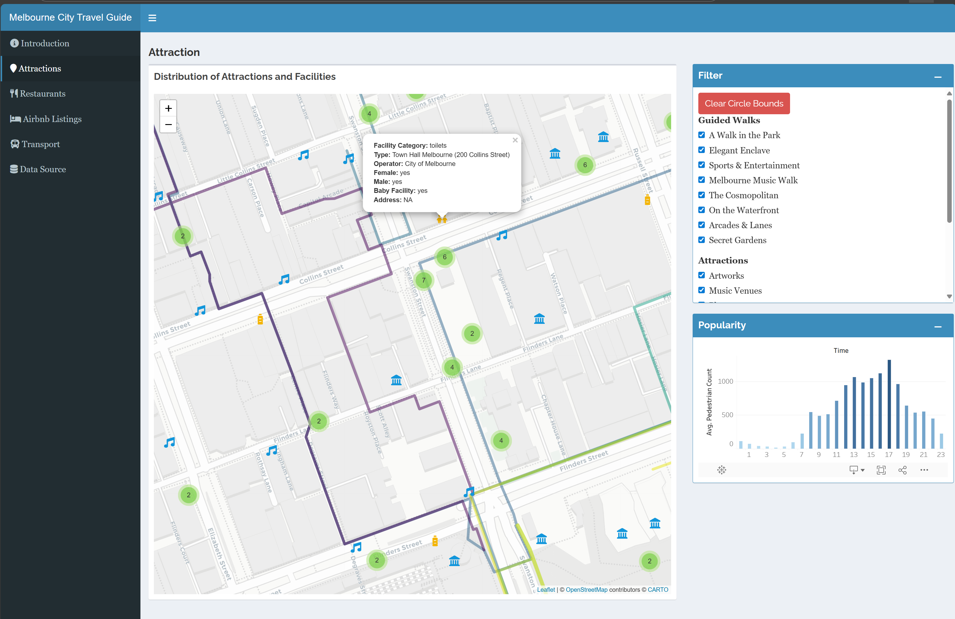
Attractions#
- Discover landmarks, artworks, fountains/monuments, guided walks, toilets, drinking fountains, playgrounds, and more—drawn from City of Melbourne datasets.
Transport & Foot-Traffic#
- Visualize tram stops/routes and overlay pedestrian counts to time visits and avoid crowds. Link out to the city’s live pedestrian system.
Smart Filtering & Map UX#
- Flexible filters (category, price, rating, distance) with synchronized map + list views for quick scanning and decision-making.
Technical Foundation#
- Framework: R Shiny app, deployed on ShinyApps.
- Data & APIs: Google Places API (restaurants/POIs), InsideAirbnb (stays), City of Melbourne Open Data (attractions, amenities, pedestrian counts).
- Visualization: Integrated with Tableau workbooks for supplemental charts/dashboards (transport and category summaries).
- Repo Structure:
R/app.R, tab modules (restaurant/,hotel/,attraction/,transport/),www/(icons/CSS), anddata/folders (airbnb, geographic, POI).